You are using an out of date browser. It may not display this or other websites correctly.
You should upgrade or use an alternative browser.
You should upgrade or use an alternative browser.
Rowing the Brazos River, Waco, TX
- Thread starter SailorDon
- Start date
gmckee1985
New Member
Looks like some beautiful scenery to enjoy while rowing. About how long of a distance was that? How long did it take you? Thanks for the video. Pretty awesome that you took time out to capture your experience. Looks like it was definitely a lot of fun. Personally, I wouldn't be able to do all that while rowing, so kudos to you for the effort.
SailorDon
Member
At 15:25 on the video, the duration was 2 hours and 30 minutes.About how long of a distance was that? How long did it take you?
The distance was 8.2 statute miles (round trip).
Taking the videos while rowing was no big deal. I mounted the camcorder on a tripod that I tied down to the aft seat of my rowing skiff.
A full charged battery is good for 180 minutes of recording and the camcorder internal memory is good for longer than that.
Launch the boat, turn on the camera, go for a row.

Editing the video and uploading to YouTube is the hard part.

You might also be interested in a more recent rowing adventure of rowing Buffalo Bayou in Houston.
Last edited:
gmckee1985
New Member
Excellent stuff man. I haven't had time to watch the second video you posted completely but from what I did see it looks like pretty awesome scenery. About how often do you go out and film? Hopefully you get a lot of views on youtube because the effort you are making is fantastic.
SailorDon
Member
I go for a row almost every day, usually 2 or 3 miles on Lake Livingston where I live. I get to see the same scenery over and over hundreds of times.About how often do you go out and film? Hopefully you get a lot of views on youtube because the effort you are making is fantastic.
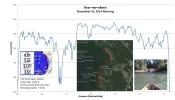
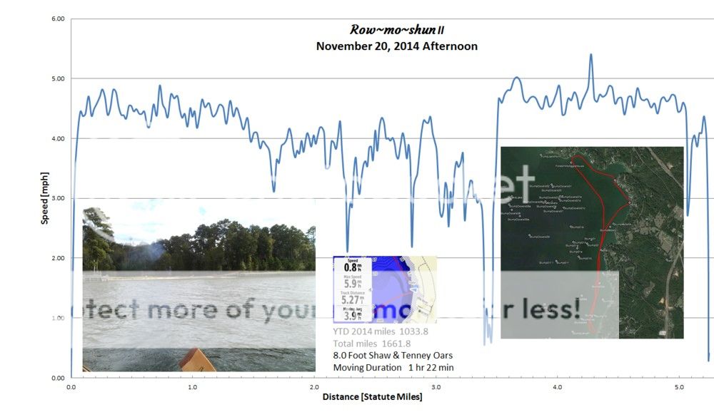
Here is my GPS log for today's rowing exercise.

It is not often I see something new, but today I saw a land clearing crew that was preparing a lakeside lot for building.

About twice a year, I will row in new locations for various reasons, like the Brazos River in Waco because I wanted to row under the Waco Suspension Bridge, and Buffalo Bayou because I wanted to participate in the Buffalo Bayou Boat Parade.
I post my videos to YouTube to share the rowing experience with those who may be interested in recreational rowing. I don't post to get a lot of views. The chance that any of my videos will go viral is Zero!
Last edited by a moderator:
gmckee1985
New Member
Very nice man. I wish I were as in depth as you are. I don't really have the time to be so detailed. It would probably help me to become a better rower, though. If I kept better track of my exercise patterns, that'd be great too. How do you do the GPS log, if you don't mind me asking? I would love to do something similar when I'm out on the water.
SailorDon
Member
My GPS performance logs are derived from the .gpx database generated by my Garmin Montana 650 GPS. After completing a rowing session, I save the GPS track on the Garmin and upload it (USB cable) onto my computer using the (free) Garmin program called "Base Camp". That displays a map of my rowing track and a database can be uploaded into MS Excel for additional processing. I chose speed vs. distance for additional processing. Usually the longer I row, the slower I go, but today, my return home was downwind, therefore faster by about 0.5 mph at the end (from mile 3.5 to mile 5.0).How do you do the GPS log, if you don't mind me asking? I would love to do something similar when I'm out on the water.

The graph is created in MS Excel. The image inserts are from the GPS built-in camera on the left, screen capture from the GPS in the middle, and on the right side is the GPS track displayed on Google Earth which is done using Garmin Base Camp (which interfaces with Google Earth).
I would like to add a cadence counter to the GPS, but the only available cadence counters are designed for bicycles and would be difficult to adapt to the larger range of motion of the oars and oarlocks. So I count the strokes per mile and determine that going into the wind and waves, I average 13 feet per stroke. In calm water I average 16 feet per stroke. With a strong wind on the stern, I can get 17 feet per stroke.
For those who are concerned about physical fitness, a wireless heart rate monitor can be easily added to the Garmin 650.


